Votre e-mail a été envoyé.

US 1 Procell 4.29+- Ac N. HIGHWAY 1 ROCKLEDGE FLORIDA 32955 Lot | Terrain commercial | 1,74 ha | À vendre | 655 781 € | Rockledge, FL 32955
Certaines informations ont été traduites automatiquement.
Informations principales sur l'investissement
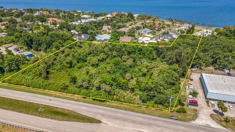
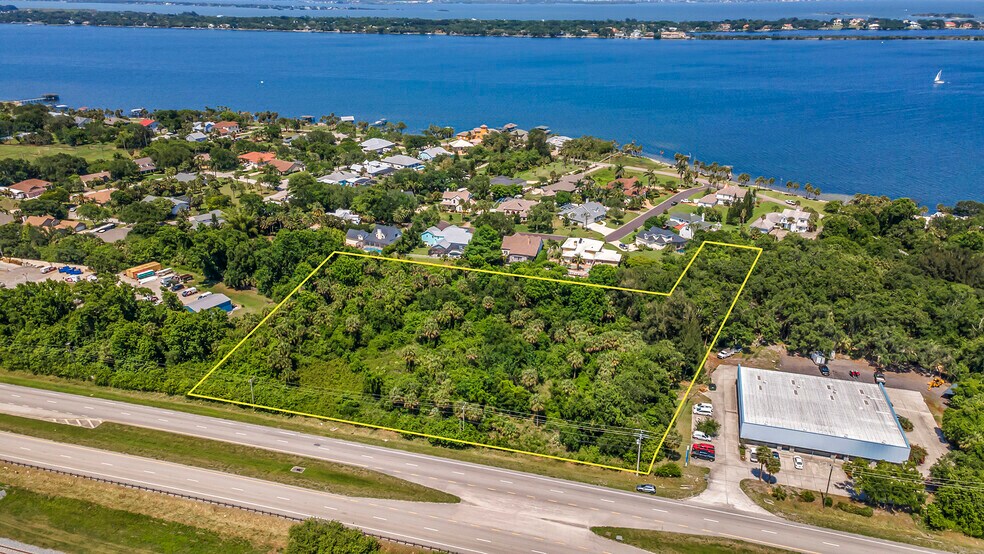
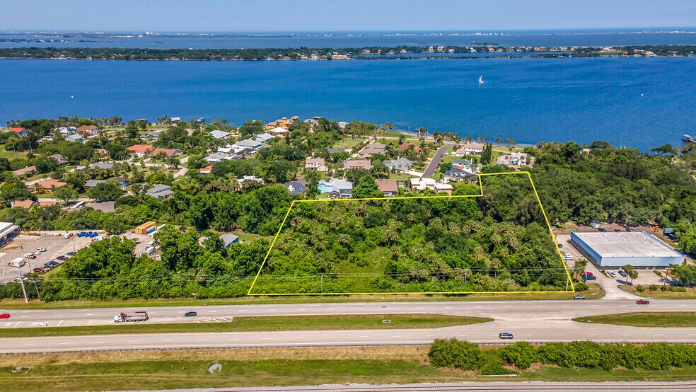
- The neighborhood is situated on the east side of North Highway 1, approximately 700 feet north of Rockledge Drive.
Résumé analytique
Informations sur l’immeuble
| Prix | 655 781 € | Sous-type de bien | Terrain commercial |
| Type de vente | Investissement | Usage proposé | Commercial |
| Nb de lots | 1 | Surface totale du lot | 1,74 ha |
| Type de bien | Terrain | ||
| Zonage | BU-1 General - BU-1 Brevard County | ||
| Prix | 655 781 € |
| Type de vente | Investissement |
| Nb de lots | 1 |
| Type de bien | Terrain |
| Sous-type de bien | Terrain commercial |
| Usage proposé | Commercial |
| Surface totale du lot | 1,74 ha |
| Zonage | BU-1 General - BU-1 Brevard County |
1 Lot disponible
Lot
| Prix | 655 781 € | Surface du lot | 1,74 ha |
| Prix par ha | 377 732,07 € |
| Prix | 655 781 € |
| Prix par ha | 377 732,07 € |
| Surface du lot | 1,74 ha |
U.S. Highway 1 plays a crucial role in the neighborhood's connectivity, running through its eastern portion and serving as a high-speed link between Melbourne, Palm Shores, and Suntree to the south and Rockledge and Cocoa to the north.
Description
It is located on the east side of N. Highway 1 about 700 feet north of Rockledge Drive in an area of unincorporated Brevard County, Rockledge, FL 32955. According to the Space Coast Transportation Planning Organization, traffic counts along U.S. Highway 1 near the Subject were 25,820 AADT during 2023. Zoning The property in question has three zoning designations that align with specific future land use plans, with the majority of the site zoned as BU-1, which allows for general retail commercial use. The EA and EU designations are primarily associated with wetland areas located at the rear and eastern portions of the site. It is possible that these wetland areas could have their zoning changed to BU-1 if a developer opts to mitigate their impact, or they could retain their existing designations and be preserved as environmentally sensitive areas. In either case, the property can support a cohesive commercial development consistent with the BU-1 zoning. Additionally, a site plan approved by the St. Johns River Water Management District in June 2009 supports this potential development. Although this site plan, which included four office/retail buildings totaling 27,490 square feet, expired in June 2014, it demonstrated that development could occur without impacting the designated wetland areas. The zoning designations for the property are as follows: BU-1 (General Retail Commercial), EA (Environmental Areas), and EU (Estate Use Residential), with BU-1 allowing for a broad range of commercial and light industrial activities. Land Use Plan The property has three future land use designations, each aligned with specific zoning classifications. These designations include Community Commercial (CC), Neighborhood Commercial (NC), and Residential 4 (RES 4), all established by Brevard County. The locations of these future land use designations are depicted on the accompanying Brevard County Future Land Use map. Utilities The Subject has availability to municipal water and requires a septic system for development. An existing 16” water main is located along the western boundary of the Subject. It also has access to telephone, cable/internet, and electricity. Topography The subject site is generally level and at the same grade as the surrounding roadways and developments, with soil conditions deemed typical and adequate for vertical construction. The property contains 1.83 acres of wetlands, accounting for 43% of the total area, with dense vegetation present that would need to be cleared for any development. There is sufficient upland space along U.S. Highway 1 to support commercial development. Specifically, a small 0.09-acre wetland is located at the northwest corner, while the majority of the wetlands (1.74 acres) are situated at the rear and southeast corner of the site. An environmental assessment is necessary if the wetlands are to be impacted, as it will determine the number of mitigation credits required. The wetlands are primarily classified as mixed wetland hardwoods, and credits for mitigation are available through the NeoVerde and Lake Washington Mitigation Banks, typically costing around $250,000 each. The previous owner's environmental assessment indicated no gopher tortoises on the site; however, a recent survey identified two gopher tortoise burrows, with relocation costs estimated between $5,000 and $8,000 per animal. The prior site plan effectively avoided the wetland areas, thus not requiring mitigation, but any future development impacting these areas will necessitate mitigation efforts.


Présenté par
US 1 Procell 4.29+- Ac | N. HIGHWAY 1 ROCKLEDGE FLORIDA 32955
Hum, une erreur s’est produite lors de l’envoi de votre message. Veuillez réessayer.
Merci ! Votre message a été envoyé.