Votre e-mail a été envoyé.

37.99 Acres, Highway 82 & Sabine Ship Channel Highway 82 & Sabine Ship Channel Lot | Terrain industriel | 15,37 ha | À vendre | Port Arthur, TX 77643
Certaines informations ont été traduites automatiquement.
Informations principales sur l'investissement
- Ideal for long term lease/development with Intracoastal Waterway access
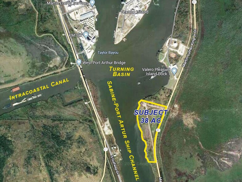
- Very convenient location on the Ship Channel at the turning basin and intracoastal canal
- The Port Arthur Ship Channel provides direct access to service companies to the thousands of Oil and Gas platforms located offshore in the Gulf
- Apron depths between 300 and 1000 feet
Résumé analytique
Informations sur l’immeuble
| Type de vente | Investissement ou propriétaire occupant | Sous-type de bien | Terrain industriel |
| Nb de lots | 1 | Surface totale du lot | 15,37 ha |
| Type de bien | Terrain |
| Type de vente | Investissement ou propriétaire occupant |
| Nb de lots | 1 |
| Type de bien | Terrain |
| Sous-type de bien | Terrain industriel |
| Surface totale du lot | 15,37 ha |
1 Lot disponible
Lot
| Surface du lot | 15,37 ha |
| Surface du lot | 15,37 ha |
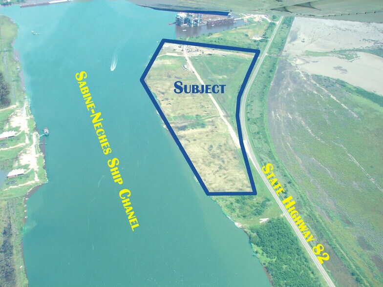
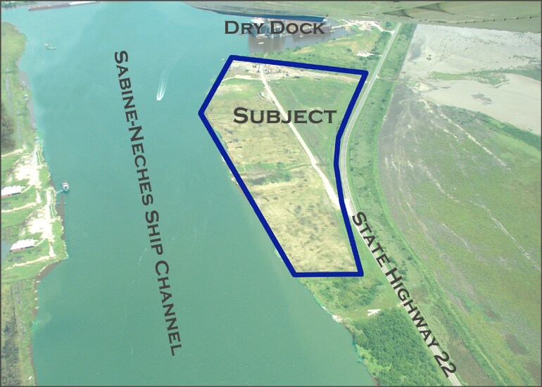
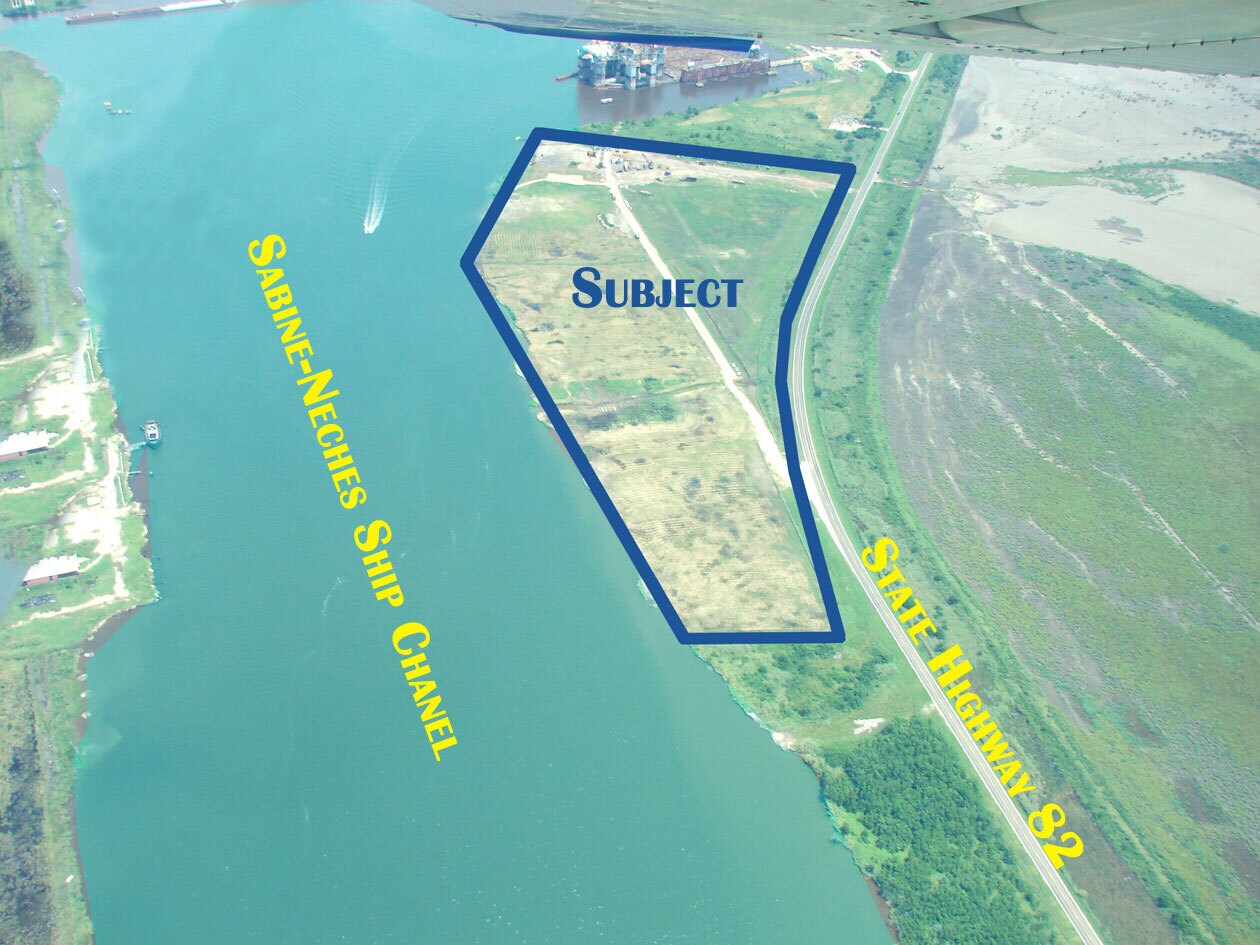
37.99 Acres of the Port Arthur ship channel facing the intercoastal canal & the turning basin. Comes with a Corps of Engineers to install bulkheads along the entire 2600 of frontage on the waterway.
Description
The property is on the deep-water Port Arthur ship channel, 10 miles from the Gulf of Mexico, at the running basin, sandwiched between the Gulf Intracoastal Waterway and State Highway 82 (on the Sabine Neches Ship Channel - the waterway ranks as third-busiest waterway in the U.S. in terms of cargo tonnage, according to the American Association of Port Authorities), on Pleasure Island, Port Arthur, Jefferson County, Texas. The property has 2,600 Feet of Waterfront Frontage (790 meters). The property comes with a transferable Corps of Engineers permit that allows for the owner to dredge along the 2,600 feet of the east bank frontage to the Port Arthur Ship Canal in order to facilitate shoreline access for future marine service operations at the subject property. The approved application had proposed to hydraulically dredge an estimated total of 385,185 cubic yards to a depth of 40 feet and extending 100 feet channel-ward in order to match the federally maintained Port Arthur Ship Canal. Please call Fred Ghabriel (713) 823-2121 or Rod Cohen (409) 350-0546 for pricing or additional details.
Taxes foncières
| Numéro de parcelle | 053110-000-005200-00000 | Évaluation des aménagements | 0 € |
| Évaluation du terrain | 935 851 € | Évaluation totale | 935 851 € |
Taxes foncières


Présenté par
37.99 Acres, Highway 82 & Sabine Ship Channel | Highway 82 & Sabine Ship Channel
Hum, une erreur s’est produite lors de l’envoi de votre message. Veuillez réessayer.
Merci ! Votre message a été envoyé.