Votre e-mail a été envoyé.

Bunford Hollow Lot | Résidentiel | 7,24 ha | À vendre | Yeovil BA20 2SQ
Certaines informations ont été traduites automatiquement.
INFORMATIONS PRINCIPALES SUR L'INVESTISSEMENT
- Prime location on the south-western outskirts of Yeovil
- Resolution to grant outline planning permission for up to 185no. dwellings
- Direct access, via the A3088, to the A303, 4.3 miles to the north-west
RÉSUMÉ ANALYTIQUE
Grant of outline planning permissions, free from legal challenge.
The Seller undertaking and completing the agreed infrastructure works.
The deed of covenant in favour of the original seller being varied to enable delivery of the scheme.
INFORMATIONS SUR L’IMMEUBLE
| Type de vente | Investissement | Type de bien | Terrain |
| Condition de vente | Projet de requalification | Sous-type de bien | Résidentiel |
| Droit d’usage | Pleine propriété | Surface totale du lot | 7,24 ha |
| Nb de lots | 1 |
| Type de vente | Investissement |
| Condition de vente | Projet de requalification |
| Droit d’usage | Pleine propriété |
| Nb de lots | 1 |
| Type de bien | Terrain |
| Sous-type de bien | Résidentiel |
| Surface totale du lot | 7,24 ha |
1 LOT DISPONIBLE
Lot
| Surface du lot | 7,24 ha |
| Surface du lot | 7,24 ha |
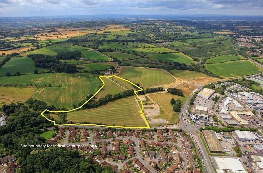
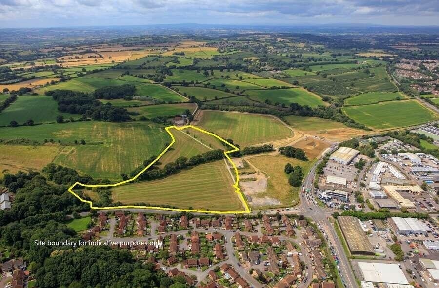
Prime greenfield residential development opportunity with resolution to grant outline planning permission for up to 185no. dwellings.
DESCRIPTION
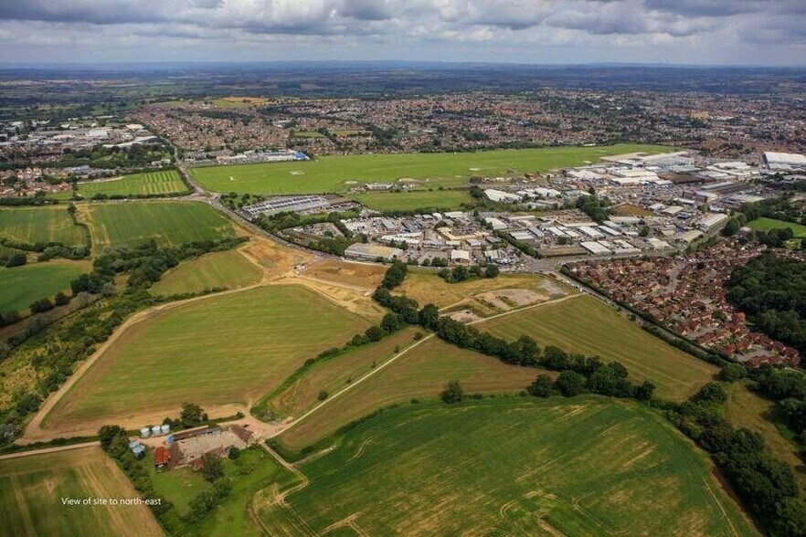
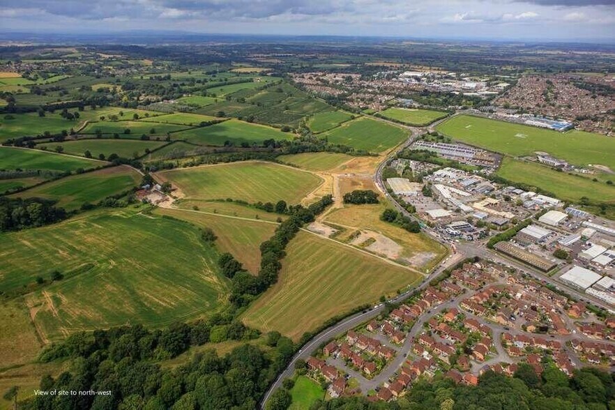
The extent of the land for sale is edged red on the site plan and extends to approximately 17.96 acres (7.27 ha). It is proposed that the whole site, excluding the black hatched land, will be transferred on completion of the access and infrastructure works to an agreed specification. The black hatched land will subsequently be transferred once the access and infrastructure works have been fully completed and adopted. The site is situated on the south-western outskirts of Yeovil and falls within Flood Zone 1. It comprises two irregularly shaped fields and is currently in agricultural use. The land slopes gently from south to north and is bounded by agricultural land to the west and Watercombe Lane to the east. The recently completed Bunford Heights development (Tilia Homes) is situated immediately to the south. The northern boundary abuts Bunford Park, which has an implemented planning permission for B1 and industrial use (see link for further information about this opportunity Bunford Park). The immediately adjoining land to the north is subject to a full planning application for a David Lloyd club, which will share an access off Watercombe Lane with the subject site (planning reference: 24/02085/FUL).


Présenté par
Bunford Hollow
Hum, une erreur s’est produite lors de l’envoi de votre message. Veuillez réessayer.
Merci ! Votre message a été envoyé.