
555 Rt 57 W
Cette fonctionnalité n’est pas disponible pour le moment.
Nous sommes désolés, mais la fonctionnalité à laquelle vous essayez d’accéder n’est pas disponible actuellement. Nous sommes au courant du problème et notre équipe travaille activement pour le résoudre.
Veuillez vérifier de nouveau dans quelques minutes. Veuillez nous excuser pour ce désagrément.
– L’équipe LoopNet
Votre e-mail a été envoyé.
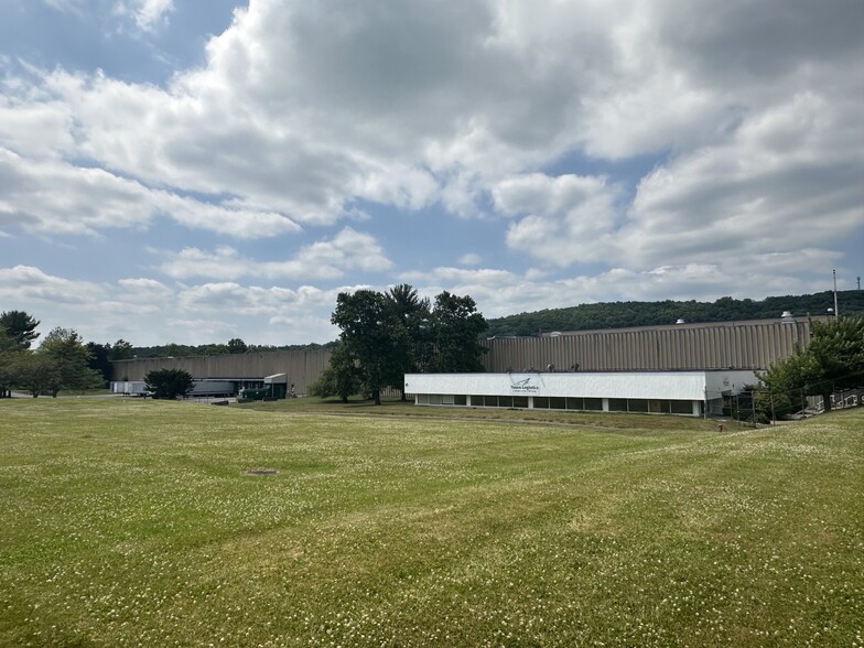
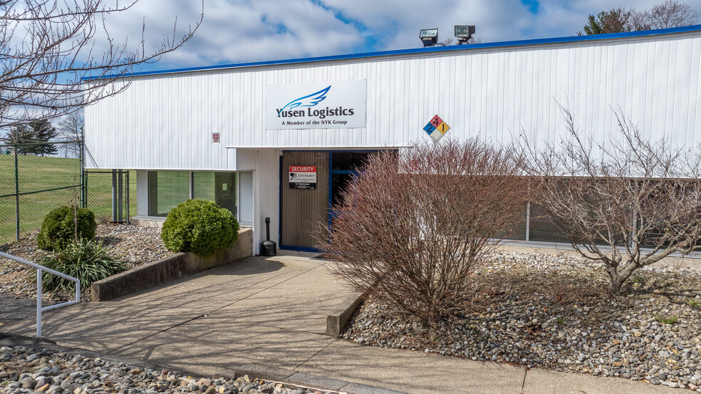
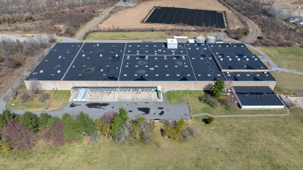
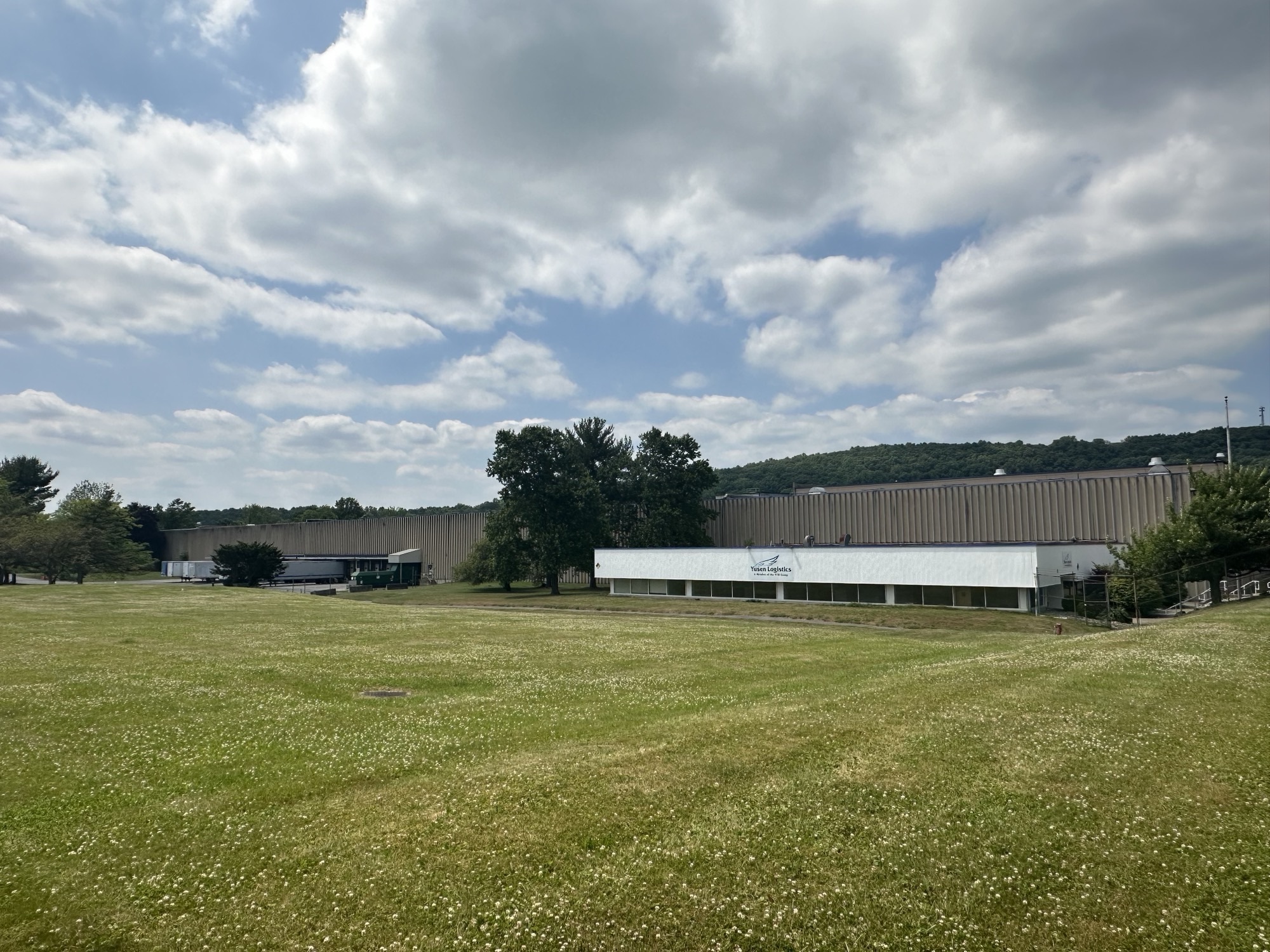
555 Rt 57 W Industriel/Logistique 20 960 m² Immeuble 4 étoiles À vendre Port Murray, NJ 07865
Certaines informations ont été traduites automatiquement.
RÉSUMÉ ANALYTIQUE
555 Route 57 is located withing the I-1 zone in Mansfield Twp, Warren County, which permits an array of uses in this rural area. The site is not located in a water service area and is currently serviced by 2 on-site wells. Additionally, the site is not located in a sewer service area and we believe it is currently serviced by a private on-site septic system. The property is located within the Highlands Planning Area which is a restrictive development overlay established in 2004 with the primary purpose of protecting open space and state natural resources. The current ordinance would permit an additional ±250,000 SF on the vacant land area to the west, assuming development viability on that portion of the site (to be further studied). The remaining acreage is currently a solar field, unlikely to be redeveloped.
INFORMATIONS SUR L’IMMEUBLE
| Type de vente | Investissement ou propriétaire occupant | Année de construction | 1971 |
| Type de bien | Industriel/Logistique | Occupation | Mono |
| Sous-type de bien | Entrepôt | Ratio de stationnement | 0,07/1 000 m² |
| Classe d’immeuble | B | Hauteur libre du plafond | 9,14 m |
| Surface du lot | 30,12 ha | Nb de portes élevées/de chargement | 20 |
| Surface utile brute | 20 960 m² | Nb d’accès plain-pied/portes niveau du sol | 2 |
| Nb d’étages | 1 | ||
| Zonage | I - industrial | ||
| Type de vente | Investissement ou propriétaire occupant |
| Type de bien | Industriel/Logistique |
| Sous-type de bien | Entrepôt |
| Classe d’immeuble | B |
| Surface du lot | 30,12 ha |
| Surface utile brute | 20 960 m² |
| Nb d’étages | 1 |
| Année de construction | 1971 |
| Occupation | Mono |
| Ratio de stationnement | 0,07/1 000 m² |
| Hauteur libre du plafond | 9,14 m |
| Nb de portes élevées/de chargement | 20 |
| Nb d’accès plain-pied/portes niveau du sol | 2 |
| Zonage | I - industrial |
CARACTÉRISTIQUES
- Terrain clôturé
SERVICES PUBLICS
- Gaz - Naturel
- Eau - Puits
- Égout - Champ septique
- Chauffage - Gaz
1 of 1
TAXES FONCIÈRES
| Numéro de parcelle | 16-01501-0000-00007-0000-S01 | Évaluation des aménagements | 74 851 € |
| Évaluation du terrain | 73 090 € | Évaluation totale | 147 941 € |
TAXES FONCIÈRES
Numéro de parcelle
16-01501-0000-00007-0000-S01
Évaluation du terrain
73 090 €
Évaluation des aménagements
74 851 €
Évaluation totale
147 941 €


1 de 11
VIDÉOS
VISITE 3D
PHOTOS
STREET VIEW
RUE
CARTE
1 of 1
Présenté par

555 Rt 57 W
Vous êtes déjà membre ? Connectez-vous
Hum, une erreur s’est produite lors de l’envoi de votre message. Veuillez réessayer.
Merci ! Votre message a été envoyé.