|

|
Certaines informations ont été traduites automatiquement.
| RUE COLLECTRICE | RUE TRANSVERSALE | VOLUME DE TRAFIC | ANNÉE | Distance |
|---|---|---|---|---|
| State Hwy 26 | Hwy 121, SW | 42 962 | 2025 | 0,13 km |
| State Hwy 121 | Hwy 26, E | 94 421 | 2025 | 0,21 km |
| State Hwy 121 | Hwy 26, SW | 1 848 | 2025 | 0,24 km |
| S Main St | Hanover Dr, N | 20 523 | 2025 | 0,27 km |
| W State Hwy 114 | Ball St, NW | 8 963 | 2025 | 0,30 km |
| State Hwy 121 | S Main St, W | 202 007 | 2024 | 0,47 km |
| S Main St | Hwy 26, N | 10 033 | 2025 | 0,48 km |
| Vine St | Airline Dr, W | 435 | 2025 | 0,49 km |
| State Hwy 26 | Hwy 114, NW | 92 398 | 2025 | 0,49 km |
| State Hwy 26 | Hwy 121, SE | 5 777 | 2025 | 0,52 km |


| Numéro de parcelle | 42925281 | Évaluation des aménagements | 0 € |
| Évaluation du terrain | 1 030 159 € | Évaluation totale | 1 030 159 € |
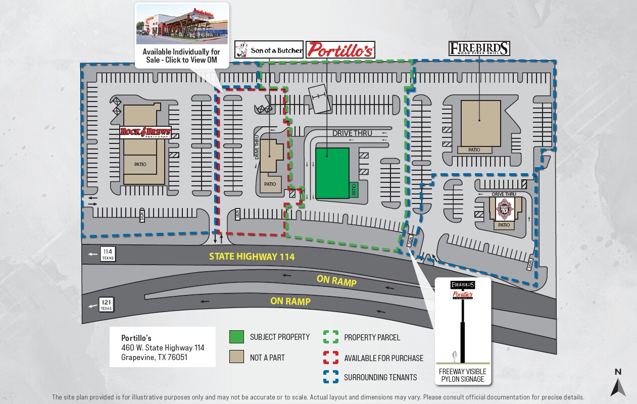 Portillos_Grapevine_Siteplan
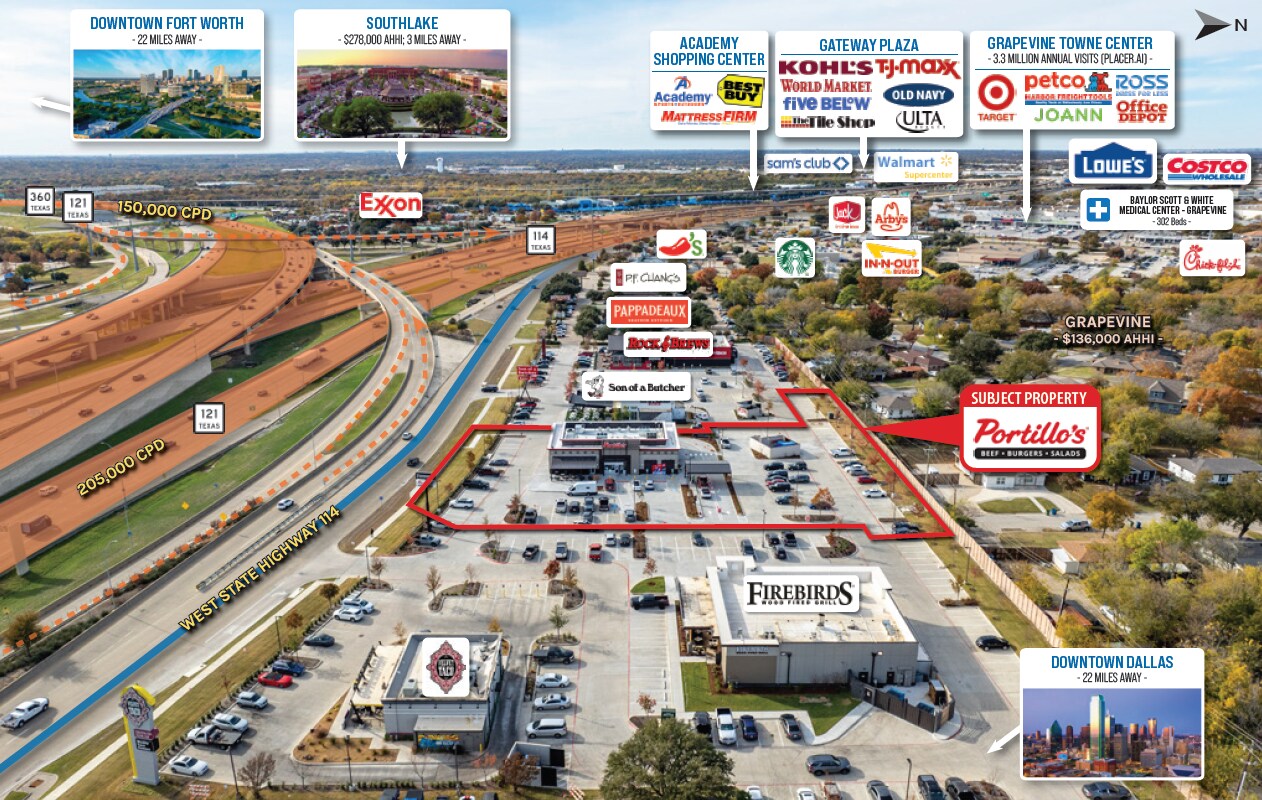
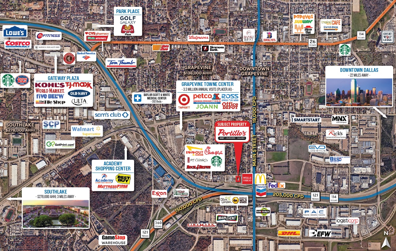 Portillos_Grapevine_Aerial2
 Portillos_Grapevine_Aerial3
Le service LoopNet et les informations qu’il contient, bien que réputés exacts, sont fournis « en l’état ». LoopNet décline toute responsabilité, garantie expresse ou implicite de quelque nature que ce soit.